

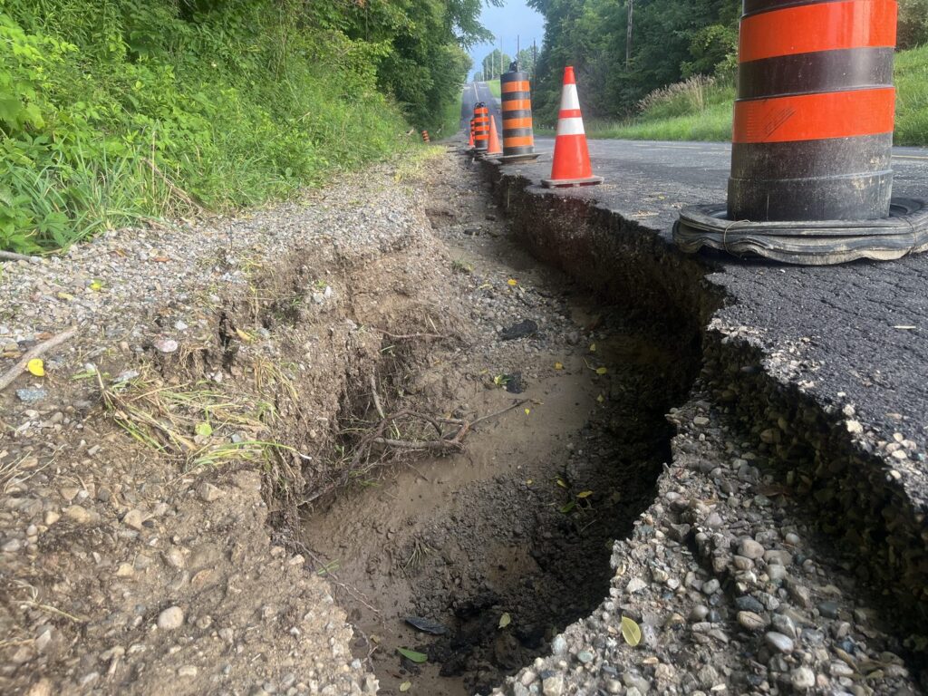
Southwold Township’s state of emergency is still in effect, more than two weeks after an August 7 storm flooded roads across the township. Township staff confirmed the declaration remains active when LocVox editor Anthony Zruna called Monday morning, and said talks with the province over disaster relief for residents’ damaged personal property are still developing, with no word yet on when, or whether, a program will be confirmed. The township’s own August 10 update had said officials were keeping the declaration in place specifically to pursue that same provincial help.
One stretch of road is still closed because of the flood. Municipal 511 lists the southbound lane of Mill Road, between Bush Line and Middle River Road, as closed for a washout, with no reopening date given. The other roads Southwold closed the day of the declaration, including Burwell Road, McDiarmid Line, Oneida Road, Hunter Line and the Sixth Line/Lawrence Line intersection, have dropped off the live closure map. That reads as good news, but it is an absence from the list, not a township notice confirming each one has reopened.
Mill Road leads to Common Ground Farm, where the Middle River Music Fest runs this Saturday, August 29. As LocVox reported this weekend, Municipal 511 is still asking drivers coming from St. Thomas to find another route.
Southwold is holding a public meeting Wednesday, August 26, on a separate but related project: mapping the flood risk along Talbot Creek. An afternoon session runs 3 to 5 p.m. and an evening session runs 7 to 9 p.m., both at the Southwold Keystone Complex, 35921 Talbot Line. The township is inviting anyone who has “experienced flooding along Talbot Creek or simply want[s] to learn more about how flood risks are assessed and managed” to come ask questions and share what they know, with project consultants on hand. It is the first public meeting the township has advertised for the study.
The study itself is older than the flood. The Lower Thames Valley Conservation Authority posted a request for proposals for the Talbot Creek mapping work on March 19, 2026, and received twelve bids by the April 9 deadline, weeks before the August 7 storm. The work is funded through the federal Flood Hazard Identification and Mapping Program, with local municipalities covering half the cost and the federal government the other half. Southwold sits in two watersheds: Talbot Creek and some of its tributaries drain toward the Thames, which is why the Lower Thames authority runs this study, while the rest of the township, along with St. Thomas and Port Stanley, falls under the separate Kettle Creek Conservation Authority, where Southwold’s own Grant Jones holds a board seat.
Southwold’s storms this month were unusual even by the standard of a wet summer. Deputy Mayor Justin Pennings has said an earlier storm around August 4 had already exceeded a 1-in-100-year event before the August 7 rain topped a 1-in-250-year one. The Kettle Creek Conservation Authority, whose flood outlooks cover St. Thomas and Port Stanley, issued its third one in four weeks on August 21, warning that rain through this past weekend could surpass 100 to 120 millimetres; that statement stays in effect until 8:30 a.m. Tuesday. Forecasts for nearby London over the same weekend were lower, with CTV News London reporting up to 15 millimetres expected Saturday. No new flood damage turned up in any of the sources LocVox checked Monday morning.
Southwold’s council does not meet again until Monday, September 14. There is no sign yet of when, or whether, the state of emergency itself will come up for a formal end.
Southwold residents with flood damage, or questions about the state of emergency itself, can reach the township office at 519-769-2010.
Sources: Township of Southwold, “Floodplain Mapping Public Meeting” notice, Township of Southwold, “State of Emergency – August 10, 2026 Update”, Lower Thames Valley Conservation Authority, Board of Directors meeting agenda, April 16, 2026
By Anthony Zruna · About the LocVox Newsroom

Before you go
You read a local story to the end, so St. Thomas news matters to you. Once a week I gather the whole week into one Friday email: top stories, the weekend forecast, what council decided, what police logged, and what's on this weekend. Free, and one click unsubscribes you.
Send me Friday's newsletter